
The average age of Google Map images is 1 to 3 years and lacks the resolution necessary for useful measurements. Nadir drone captured imagery is the ideal solution if you need something more current.
Orthomosaics stitched by Maps Made Easy give you a birds eye view of your construction project, inventory, or agricultural fields. Automated flight patterns allows for precise map layering in case you want to view progress by drone shoot date. Perfect for construction or crop progressions.
Please note, while still more accurate than using Google Maps, these are non survey grade renderings. No special Ground Control Points (GCP) hardware is used. These maps should only be used as a rough overview when taking measurements.
Relative accuracy margin of error: Horizontal <1%, Vertical <2%, volumetric measurements <1%
DJI Specific Workflow: Photogrammetric processing that uses the image’s geotags to produce the full complement of image and 3D outputs. DJI’s embedded XMP tags provide extra information at the time of upload.
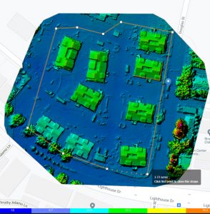
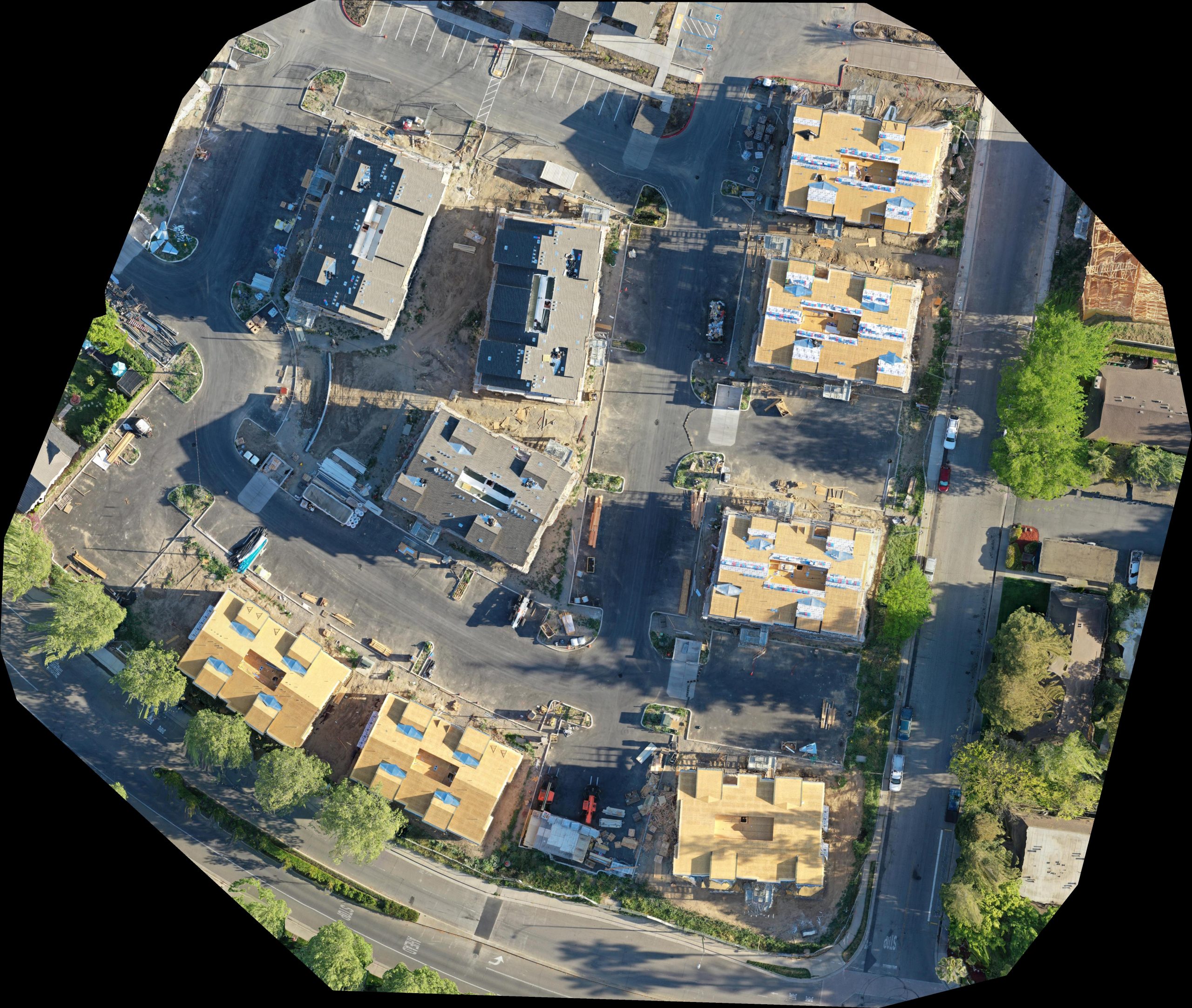
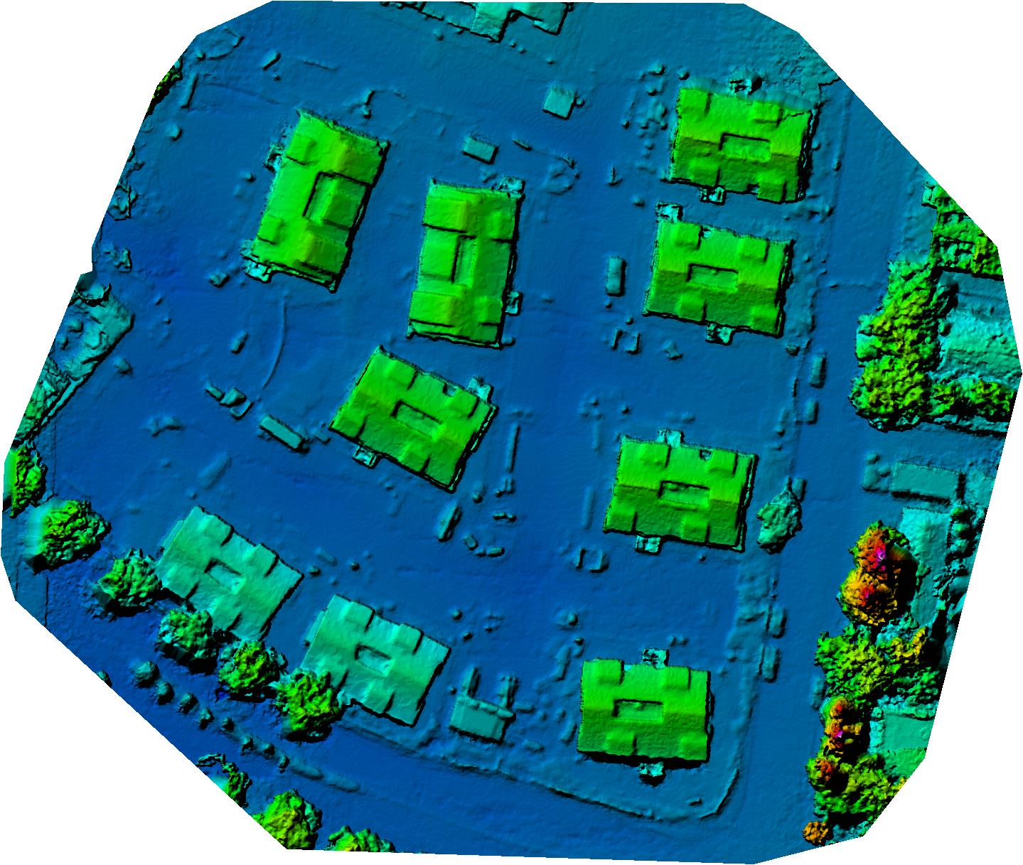
Case Study: The Strand Apartment Homes. Flown in nadir mode using a DJI Mavic 2 Pro drone and Ground Station Pro flight automation software. More map layers to come as the project progresses.
Nadir Construction Progression by Date
Nadir Orthomosaic with Elevation Grading
Advanced Output Downloads: GeoTIFF (46MB TIF), Full Resolution JPG (JPG), DEM GeoTIFF (TIF), Colorized DEM GeoTIFF (TIF). Colorized DEM (JPG)